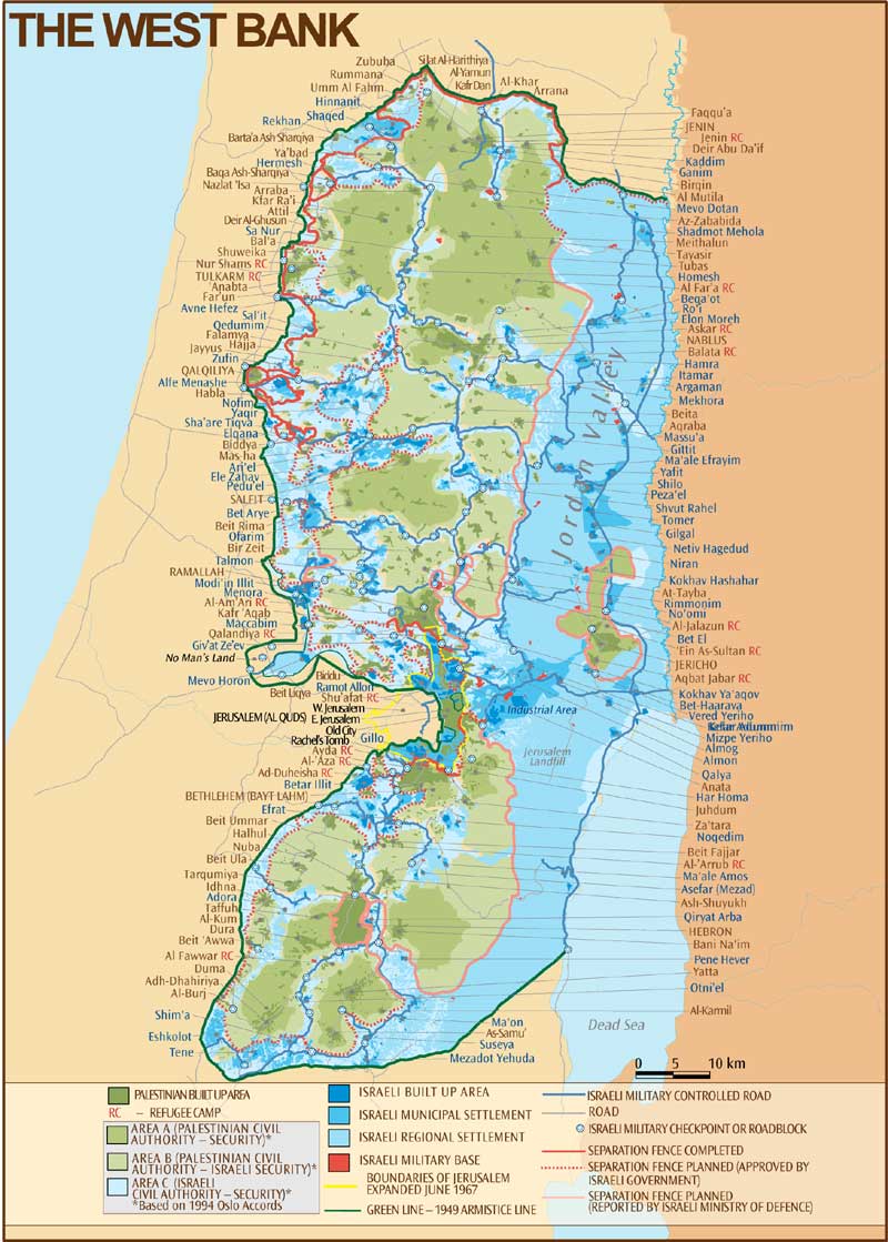
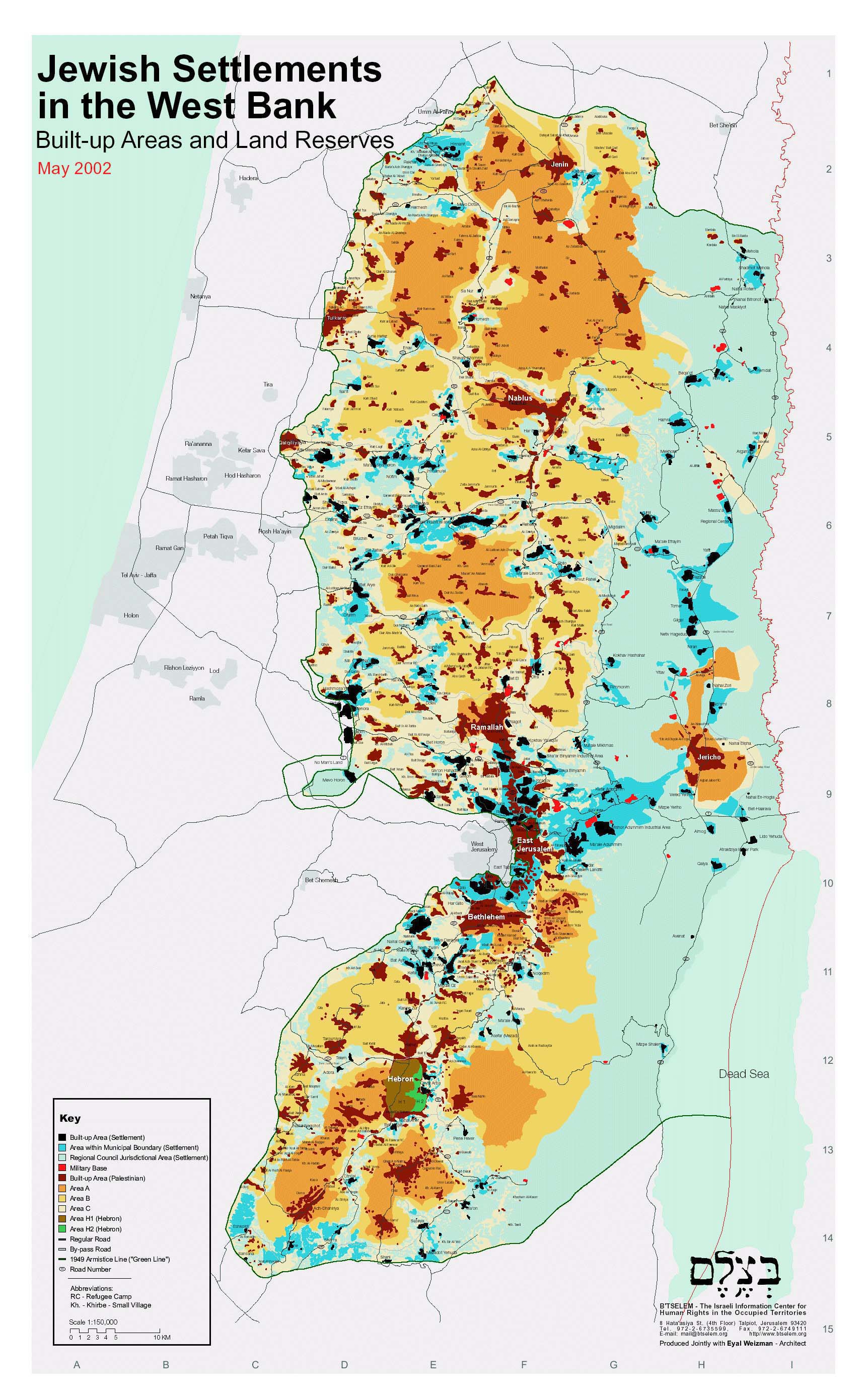
Map Sources:
Btselem; The Israeli Information Center for Human Rights in the Occupied Territories:
"Jewish Settlements in the West Bank; Built Up Areas and Land Reserves"; Produced jointly by B'Tselem and Eyal Weizman.
www.btselem.org/Download/Settlements_Map_Eng.jpg"
Check points and roads:
Applied Research Institute Jerusalem "Check Points and Roadblocks North of Jerusalem", "Roadblocks Around Jerusalem"
www.arij.org
Palestinian Red Cross Society
www.palestinercs.org/reference_maps.htm
Separation Fence:
Btselem; The Israeli Information Center for Human Rights in the Occupied Territories; "The Separation Barrier"
www.btselem.org/english/Separation_Barrier/index.asp, www.meretzusa.org/map_btselemfence.pdf
"Jeruslalem Envelope"
www.btselem.org/english/Separation_Barrier/Jerusalem.asp
Passia: "Israel's Separation Fence; Completed and Projected Sections -- July 2003 and Palestinian Lands"
www.passia.org/palestine_facts/MAPS/newpdf/Seperation-Fence-July2003.pdf
Palestine Monitor: "Isolation of Jerusalem"
www.palestinemonitor.org/maps/Isolation_of_Jerusalem.htm
UN Office for the Coordination of Humanitarian Affairs (OCHA) "Enclaves and Closed Areas between the Wall and the Green Line" Wall path based on Israeli Government
(Ministry of Defence - Seam Zone Authority) Maps, published 23 Oct 2003
http://www.reliefweb.int/w/map.nsf/Emergency?OpenForm&Query=Occupied+Palestinian+Territory
Disclaimer